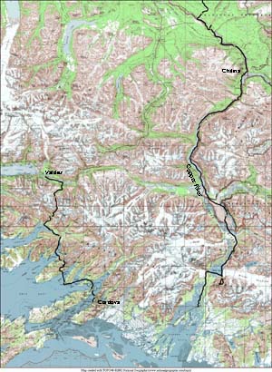
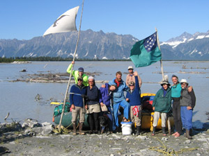
We parted ways with David in Chitina, and went on to packraft down the rest of the Copper River. The lower Copper was vastly bigger than anything we'd rafted before, and it took a bit of getting used to, particularly the fact that we had to start ferrying to avoid rapids about 3 miles before we hit them. We were lucky enough to run into a really cool group of people coming down the river, and we hooked up with them for the last half of the trip, becoming the little duckling rafts to their larger mother duck boats. This led to a somewhat more relaxed pace than we're used to, but we managed to make it difficult for ourselves anyway, by starting an 11 hour day hike at 1 PM. The Copper cuts through steep mountains, and flows past two glaciers that calve directly into its waters. The weather continued to be beautifully sunny, and it was an absolutely gorgeous place. Read journal entries and pictures below.
8/20/04 - day 1 |
| Into the flood |
|
We're all alone again, and in the presence of enormity. We've left David and his nice headlamp back in Chitina, so I'm writing by the flickering red light of my malfunctioning LED. The stop in Chitina was just long enough to get ourselves stuffed, showered, and our errands accomplished. Now I'm happy to be going again. We're back in the wilderness, but in a wilderness more accessible than most.
|
|
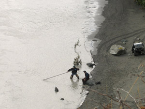
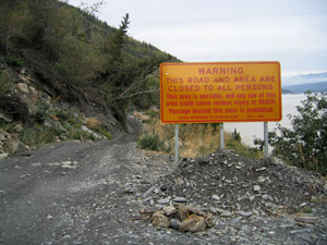
We followed the railroad grade road 10 miles out of Chitina, passing a jogger, mountain bikers, salmon dip netters, and a pair of signs warning dramatically of danger and death for anyone who goes on this unstable road. The signs were about 150 yards apart, facing out on opposite sides of a fairly unremarkable patch of this well-used gravel road.
|  |
 |
|
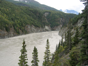
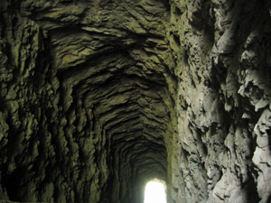
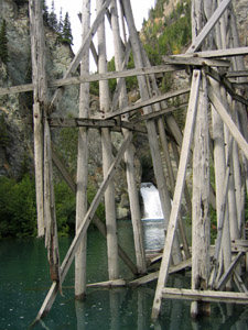
The road wove along with the riverbank, dropping down and up where the old railroad trestles had been, and shooting through a couple rough-walled old tunnels. We had a good roadside view of much of Wood Canyon, and at every pullout we stopped to look out over what we were missing.
|
 |
 |
 |
|
Tim said we could raft the canyon if we stayed to the middle and avoided the eddies on each side. Other packrafters had told us we couldn't. We decided to take the safer route and look over the canyon from above. We still have a lot to learn about rivers this size. It looks like Tim was probably right, looking from above. I'm just not sure how easy it would have been to stay in the middle.
The river today carried us at about 6 miles an hour - slightly slower than the Copper before the confluence with the Chitina. But we were trying to stick to the slower water, and where the current moved fast, it moved. |
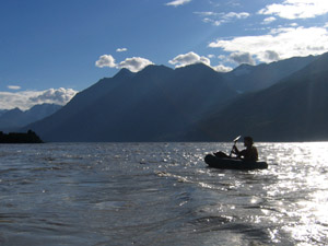 |
On a river this size, figuring out where you're actually headed is far more of a challenge than I realized. The currents move back and forth across the river, splitting and rejoining, slamming into rapids on a bedrock bank, or slowly drifting over a gravel bar. Figuring out where the current is taking us exactly, or how to navigate the current maze to get to a spot we want to be (or more often out of one where we don't want to be) is a whole new challenge. It makes me a bit nervous when the banks roar with rapids, but otherwise is kind of fun.
|
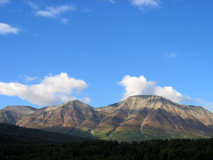 |
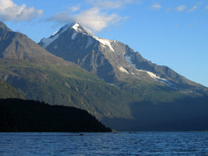
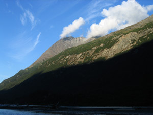
The wind blows up the Copper River Valley, bringing cool clean air from the ocean, and driving the smoke away. The rain spatter of this morning cleared up early, and as we paddled we were chased by the sun. Bright evening sunlight and scattered clouds made the mountains come alive in the clear blue sky. Cloud shadows played over them in patterns of stripes and blotches, and the low angle of the light made every ridge pop out in full three dimensional glory. I took pictures whenever the water was slow or the 30 minute timer on Hig's watch beeped. We're trying to use the timer to get a more consistent view of how the scenery moves by. A low frame rate movie, of sorts.
|
 |
|
All is well but the patch job on my raft. The glue again has cracked, and the raft slowly hisses from the valve. We've glued it yet again tonight, still with our inferior glue. I hope one of these times it really works, since new glue is hard to purchase on the banks of the Copper.
|
 |
|
8/21/04 - day 2 |
| Down the wide brown road to a meeting of coincidence |
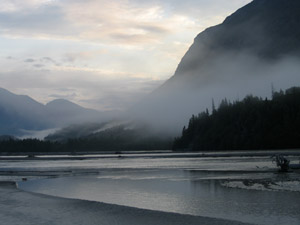 |
Floating the Copper is almost like being on a road, at times. It's a vast wide ribbon of brown and as we sit there, we travel along far faster than walking speed. But the Copper is both much slower, more peaceful, and far more impressive than a road. |
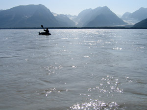 |
We flew down the river, watching the scenery drift by in the bright sun and calm. There weren't many rapids to avoid today. Hig says it's a little like trail hiking, only less canned. No one made the Copper River for our enjoyment. |
|
As we traveled downstream, the mountains grew glaciers. They hung on to steep slopes, poured over cliffs in stair steps and crevasses, and shone all of bare ice in this hot year. Where the glaciers ended, waterfalls began, falling in white roaring lines down the steep gullies. The breadth and flatness of the Copper River valley seems so improbable a neighbor to the steepness of the mountains.
|
|
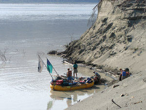
We were headed for the island for our siesta. On the map it shows up as an enormous speckled tan peninsula. It is a great flat tongue of sand dunes separating the Copper and the Bremner Rivers. And at the island we found rafters splashing in the water and scurrying into their clothes. I wasn't to surprised to see rafters on a large and well known river like the Copper. I was surprised to have so many connections to them. David Grimes, from Cordova, was the river expert. He told us all about the river, and it turns out he'd been down it with Tim Robertson (a Seldovia friend) two years ago. The rest of the group was from the Talkeetna area. One knew Sheri Tingey and recognized our rafts, a few knew Gordy, and they knew quite a bit about the Wilderness Classic, or at least the Talkeetnas route.
|
 |
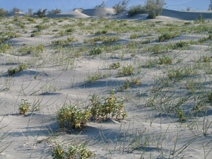 |
They invited us to camp with them tonight, but it didn't work out for us to make it that far. Our plan was to head across the island, put in on the Bremner river, and float back down to the Copper. Partly to be different, and partly to get a better chance to explore the sand dunes.
|
|
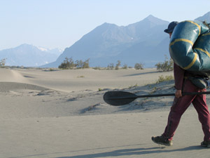
So we trekked out across the desert with rafts and paddles in tow, searching for a shady resting spot to cook our lunch. And then it was on to the Bremner. We wandered left too early, and finished our crossing not in sand dunes, but in fishy swamps.
|
 |
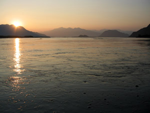 |
The Bremner was slow. Slow, shallow, and full of sandbars. A weird oily slick floated on top of it, gathering sand on its bubbles. It was too slow for our tastes, fresh from the Copper and too far to float down it to get there. So we watched the beautiful sunset as we paddled down, and bailed back to our sand dune island. Tomorrow we walk back across, to see more again of the dunes and to rejoin the greater river.
Hopefully we'll run into our new friends again downstream somewhere.
|
|
8/22/04 - day 3 |
| Gaining guides and companions |
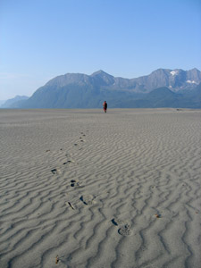 |
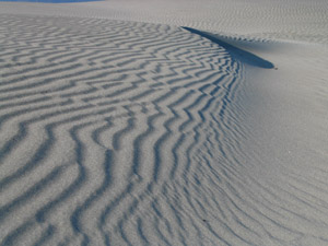
The sand dunes we crossed this morning were even more striking than the ones we crossed yesterday. At least that makes a good excuse for our otherwise completely inefficient route zigzagging back and forth across them. The channels of the Copper that butt up against the sand dunes are at least as slow and shallow as the channels of the Bremner. But we poked and paddled our way back into the current proper, and eventually resumed our rapid flight down the landscape.
|
 |
|
We woke up early and had a meal and a fire to warm us on the shadowed dunes, but by the time we got across them the sun was fully up and beginning to beat down on the sand. Smoke haze obscured the features of the surrounding mountains as a legacy from the unusual down-valley breezes yesterday.
We drifted into a narrower gorge and faster water, debating whether and how Baird Canyon could contain any trouble and where we ought to be to avoid it. There really wasn't any trouble, and as we shot down through it I caught a glimpse of yellow on the far left bank.
It was our friends from yesterday, and we made a hurried ferry across the river to land and join them. Luckily it was a narrow spot in the river, since we couldn't've made it much further. And there we began to acquire some new friends. We talked about our funny little rafts while David and Dulce told us about the river and we all wandered up the slope to look out over Allen Glacier. |
 |
|
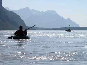
We snacked on sorrel, watched the glacier and the waterfall, enjoyed the sun, and heard bits of history about Alaskan environmental politics. Then we tagged along behind to the scout for Abercrombie Rapids, as little turquoise ducklings by the big mother green and yellow boats.
|
 |
|
There was a lot of discussion and a lot of looking at Abercrombie. We even rode down it on their big rafts, and got to see how a larger and heavier boat could move through it. And we probably could have done it in our boats too. It looked like we probably could, but I wasn't quite sure, and the consequences of a screw up seemed too high for comfort. With that, plus advice not to, plus the fact that it was really easy to carry our boats around, we decided to walk.
But first we borrowed some glue and did a quick goop of patching on my raft valve. Which promptly failed when I tried to blow it up again about half an hour later. And we didn't even leave it that long for the second goober of glue, when I tried it a second time. This was most of our mistake.
|
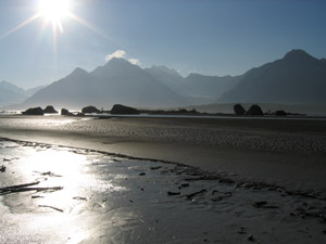 |
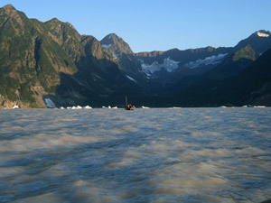
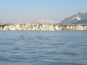
We jumped right in with eagerness; little ducklings headed for the center of the universe. We'd heard about this place from Tim Robertson, who'd been there with David in the past. It's a little valley snuck in next to the retreating face of Miles Glacier, and only opened up for passage in the 90's. We had to go see it.
|
 |
 |
 |
As we approached the face of the glacier, the air temperature dropped and a stiff breeze blew out, flinging cold sandy air off the sand spit. Our duckling boats could outpace the mother ducks in the wind, with their low profiles, but as soon as the breeze died down, we fell behind.
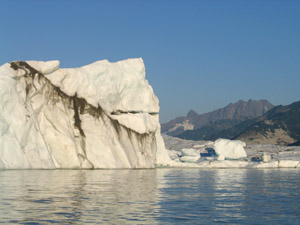
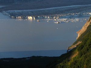
Behind into a field of icebergs, born from the face of Miles Glacier, and slowly melting to their doom in Miles Lake. It was a beautiful spot, lit by the late evening sun. Except for the raft leaking. Here was the real problem with a series of repeated half-assed patching jobs. It came in the form of a long lake full of icebergs and short on beaches to stop and reinflate the raft. Hig thought I'd be fine to reach shore in time, even without trying to reinflate while floating. And he was right, but man was I nervous by the end, sitting in a very squooshy raft which reminded me of nothing more than a floppy wet noodle.
|
|
I don't want to leave here before doing a proper patch job, but luckily we'll be here probably all of tomorrow, since we've decided to extend our stay and mooch a ride to Cordova. We wandered over to join the cook fire tonight and were quickly overwhelmed. I haven't seen so much stuff or so much really good food camping since the Colorado River rafting trip. I wanted to help, but wasn't quite sure what to do. So we ended up just sitting and enjoying. Fresh salmon and vegetables and salad and rice and good conversation. Between all the people on this trip, there is enough back country experience and stories to fill a dozen evenings.
I only wish I wasn't chilly from being wet in the raft. With our 10PM cooking time, this is a late writing session and a late bedtime. It's dark enough again to get a peek at the northern lights in our always clear sky.
|
|
8/23/04 - day 4 |
| Day hike fiasco |
|
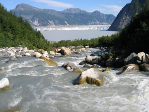
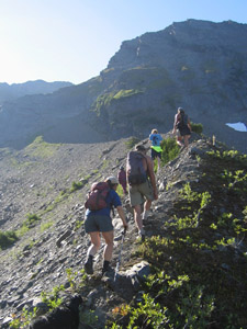
There's a reason we don't usually do day hikes where we leave our gear behind. And there's certainly a reason not to begin an 11 hour day hike at one in the afternoon. |
 |
 |
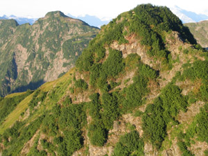 |
Of course it wasn't an 11 hour day hike for anyone else. It was a pleasant boulder hop up the creek, followed by a somewhat tricky scramble. And after that, everyone more or less went back down, after greater or lesser attempts at first reaching the peak. Not us. We traversed and traversed, continued our nerve-racking scrambles, hoping we'd make it to the ridge without being cliffed out. |
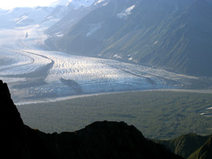
At the base of every rise we felt the ridge was almost within our reach, only to see yet another shelf rising up in silhouette beyond us. Once we got to the ridge, we had to hope we could scramble all the way down the other side, or have to backtrack back. It was getting late. After a few hair-raising spots, we did make it down. And after a few nice meadows and huckleberries we had a long slow bushwhack through alder and devil's club to the creek. The scramble down the gully we completed in the dark, under starlight. We groped our way over slippery rocks, thankful for the white granite boulders, which were easier to pick out in the gloom. A bit after midnight, we finally made it down to camp. And all I have to show for this fiasco is a bruised shin and a view from high above Child's Glacier, which we'll float past tomorrow.
|
 |
 |
|
8/24/04 - day 5 |
| To Cordova |
|
Last night while I was coming down the creek, the only thing I wanted in the world was our nice warm sleeping bag. Once I found it, I was far too tired to adequately describe either the high points of the journey or the miseries of our starlight bushwhack return. Memory of misery and pain fades quickly, and today found us describing to Dulce and David how to get up where we had come down.
Today was a whirlwind of action and passivity that landed us with a blur in an informal campground just outside of Cordova. We woke up barely past 6 to a friendly voice and a beeping watch, and I was propelled into my raingear and wet socks and shoes by the possibility of hot coffee at their cook fire. The coffee propelled me into a quick neat job of packing, and 40 minutes later we were standing by the shove with our brand new non-leaking rafts, feeling a bit chilly and a bit useless as we watched gear being loaded into the big rafts.
|
|
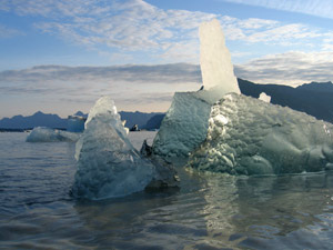
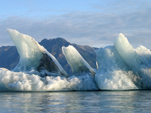
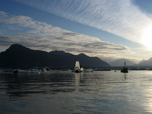
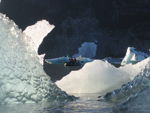
We took off for the ice and the sun, which had risen just enough to hit all the icebergs on Miles Lake. Fresh faces of ice gleamed an eerie green, and the low sun beamed through the thinner spires of ice until they glowed from behind. We dawdled and photographed them, happy for the excuse to wait in such a place. |
 |
 |
 |
 |
 |
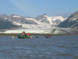
Then the mother ducks showed up, and we were going. As baby ducks we kept close to our parents for most of the morning, paddling back and forth between them and only occasionally going astray. We even picked up food from the mother ducks, paddling alongside to grab a slice of cheese on a cracker, or a slice of apple.
|
 |
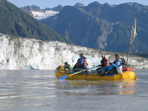 |
At the end of Miles Lake the river runs up against the face of Child's Glacier and is spanned by the million dollar bridge. The bridge may have cost a million dollars in the day of the railroad, but it's costing many millions to repair it now. An expensive bridge to nowhere, which is touted as a historical preservation effort, but is widely believed to be the first step in a plan to build a road to Cordova.
|
|
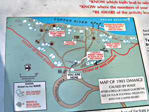
Child's Glacier is to ice calving what Brooks Camp is to brown bears. The road ends (not counting the newly fixed bridge) just across from the ice face. This allows tripods to be set up on the stable ground, and people can watch the face at their leisure, only occasionally being washed away. On the road there is a very graphic sign showing a standard campground map, complete with little graphics depicting the path of picnic tables as they were carried away and overturned, fallen trees, and people trapped under enormous cartoon boulders of ice. Alongside this bizarrely humorous damage report are a couple of articles describing the 1995 ice calving that caused it.
|
 |
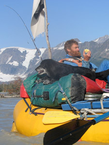 |
Nothing calved while we were passing, and we swept down out of the mountains into the Upper Copper River Delta. The river was fast again, and the space between us and the bridge zoomed by in a flurry of conversation and a series of confusing left turns in channels bounded by dead and fallen trees. Harbor seals were even more abundant here than up at Abercrombie, and the dog was desperate to hop in and chase them.
|
|
Suddenly, we were at the bridge, and mother raft was pushing a channel through floating wood which blocked the landing spot. We packed things, helped move gear into the three greeting vehicles, took group photos, exchanged addresses, and hopped into the van as it hurried down the dusty road to the airport, through ponds full of tundra swans that let the van get far closer than they ever let us get in the wilderness.
We landed in Cordova with a pile of suggestions and spent the rest of the day wandering around on errands and asking people how to get the pictures off our memory cards and onto CDs. We did finally find such an establishment, which sells clothes and oriental groceries in addition to being a camera shop. Hopefully all will work out, though I feel very nervous having left our baby the camera and all its pictures in the hands of a stranger. My reflexive checking that one of us still has the camera is all in vain. We're camped tonight in a squatters' campground known as The Cove, but too tired to check out the free sauna. Maybe tomorrow.
|
 |
|
